|
|
 |
A. ANTHROPOGRAPHIC REVIEW OF THE ATHOS PENINSULA
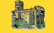
From the middle of the southern side of Central Macedonia and to the south-east, towards the Aegean Sea, extends the peninsula of Chalkidiki, which, at the north, as it is known, separates from the other Macedonian land by a deep “ditch” that begins from the cove of the gulf Thermaikos and reaches up to the cove of Strimonikos. Southerly and easterly, there are three narrow, long and almost parallel pieces of land, which look like fingers going deep into the sea. Each one of these "fingers" can be found with various names in the works of ancient and later Greek historians and writers. The most commonly used names are: for the western finger Flegra, Pallini and Kassandra, for the finger in the middle Sithonia and Loggos and for the eastern one Athos, Akti and Agion Oros. The position of these three peninsulas, their shape, their fertile ground and their rich subsoil, their climate and flora, as well as the wealth of the seas that surround them attracted may people who decided to come and live in these beautiful places.
The Athos peninsula begins from the narrow section that separates the gulf of Ierissos from the gulf of Siggitikos. Its length reaches almost 60 kilometers and its width varies between 8 and 12. The total area reaches 385 square kilometers. The mountainous character of Athos is revealed immediately after the canal, from where a small elation of ground begins that continues up to the Megali Vigla. The later has an altitude of around 90 meters from sea level and constitutes today the political borders of the State of Athos according to the Greek Constitution. Then, the ground rises even more and continues henceforth as a smooth ridge at a length of 22 kilometers. It is the known Megas Zygos, which presents the image of an almost smooth mountain that reaches up to the narrow piece of land that is defined by the bays of Vatopediou and Konstamonitou. From this narrow part and thereon, the peninsula becomes mountainous and inaccessible. The mountains, full of forests, lead to many and inaccessible tops of 500 meters and more in height, from which two are the most important: the one of Kriovouniou and the one of Tsouka. The main mountain of Athos follows; it is shaped in naked, usually anonymous, mountain peeks, with an altitude of up to 1000 meters that are separated with deep canyons, abrupt mountainsides and scary ravines. Far from these mountain peeks, at about the edge of the peninsula, the usually white from snow acute peek of Athos rises suddenly, alone looking like a beautiful pyramid, sometimes lost in the dense fog and other times crossing the Greek blue sky at the extreme height of 2.033 m.
According to some experts, the Athos peninsula, just like the peninsula of Chalkidiki, was formed during the early geological years. The opening of the land and the sinking of several parts of it from both sides proceeded, followed by ascending and descending movements of the land and of the sea. Thus, with these tectonic changes, the peninsula of Athos, just like other regions of southern Macedonia that suffered from seismic activity, was topographically formed, a formation that, as it was observed, presents the following main characteristics: abrupt mountainsides, steep rocks, deep and narrow watercourses of torrents and irregular and sharp perimeter of Athos. The subsoil of the peninsula of Athos is considered as particularly rich in old volcanic and other rocks that can be found in various regions. Specifically, the northern part of the region of Chelandariou, the southeastern edge of the peek of the mountain and the southern edge of the peninsula are constituted by white and almost without layers durable crystalloid limestones, the known marbles. The layers of these rocks, if they exist, are vertical to the oblong axis of the peninsula. Between the marbles and the slots, there is a series of water-veins that supply various springs, small or big, which provide plenty and cool water during all seasons of the year. The benefits of the underground reservoirs are very important, encouraged by the natural covering of the soil with dense forests and underground hard rocks. Forests retain water during the rainy seasons and rocks do not allow water to escape in big depths. The lack of rivers is attributed by experts to the mountainous character of the landscape. On the contrary, the torrents of the mountain and of its region are many and their water that comes from the rains and the snow that melts flows impetuously and causes great destructions.
The climate of Athos is Mediterranean. In the winter, that is soft in lower areas close to the sea and very cold in higher areas, the rainfalls reach their “highest level”. Summer is relatively dry. It is normal for these climatic conditions to change at the mountain ranges and at the peek of Athos, where due to the height, there is snow until the end of April or the beginning of May. There are two factors that play a very important role in the climatic configuration: the sea that surrounds the peninsula of Athos and the peculiar central trunk of Athos with its huge arrow looking peek. According to the equitable observation of W. Rauh, the northern and northeastern winds crash into the northern side of the mountain, expand towards the peek and fall in the embossed surface of the peninsula with an enormous intensity just like descending winds.
On their way down, they effuse towards the lower peeks, the valleys, the slides and ravines and thereon, they acquire a course proportional to the territorial elations and cavities. To this fact are also attributed some small differences in the wind direction that is observed locally.
One of the main elements of the areas on Athos is the very rich and peculiar vegetation. Trees, bushes, small bushes and other plants cover about 98% of the surface of the peninsula. The abundance of forests and bushes and the variety of flora composes a rare carpet of green that for many centuries has characterized the region as botanic paradise.
This rich vegetation presents a zone type structure. From the beach to the peek of Athos, the region is separated in five areas: the coastal, the area where evergreen and hard-leaf trees grow, the area with wood plants, the main forestall area, where deciduous and broadleaf trees grow, as well as acicular coniferous trees and the Alpine area.
|